Showing posts with label tiverton parkway. Show all posts

20210812

I found a gem!

OpenTopoMap is the best free mapping service for hiking and cycling that I have found, but it gives no indication of whether a path is a right-of-way. In contrast UK Ordnance Survey maps do show right-of-ways e.g. here and I include an excerpt below for comparison, moreover this site is devoted to showing them. 

My track 12.6 miles


The gem, in OpenTopoMap


Same area in Ordnance Survey 1:25000

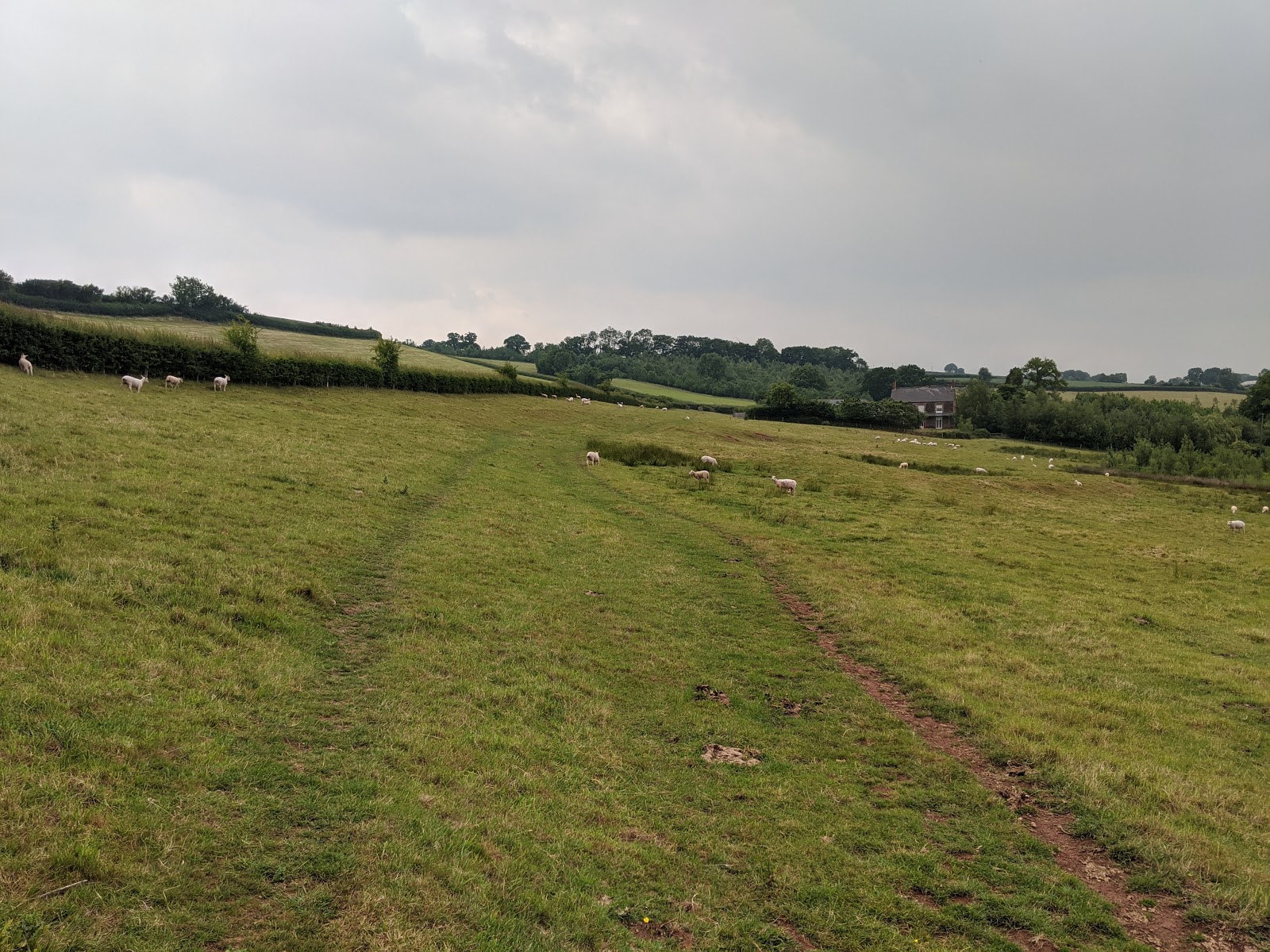
So, I headed north along the Tiverton Parkway cycle route and found the entrance to the "gem" between the station car park and the small pond.  This path is omitted on the Ordnance Survey and FPM maps because it is a "permissive path" and not a right-of-way, and yet the land owners have done an amazing job: lush cut grass underfoot, occasional areas with picnic tables, and appropriate well maintained fencing and gates.

Check out my photos below. Click on any of the images to zoom in. 

Note the GWR up and down trains passing...

...in the near distance

No, I didn't ingest any without relizing (sic) it!

This right-of-way crossed someone's garden

I followed this typical Devon road

View from highest point

 And on the way back I checked out that elusive footpath at Whitnage.

20210530

Culm valley


22.4 miles, elevation gain 442m

Another cycle ride, this time exploring the upper Culm valley. I had sort of hoped to find the source but turned back too soon, about 2 miles too soon in fact. The source is somewhere in the distance of my first photo. Beyond those yellow buttercups.

Besides, river sources are overrated and usually disappointing, that's if you can even find them. But it was a glorious day and the Culm valley is so very beautiful.


Turning into Hidewood Lane

Reduced to a small stream at my extremity

The bike that brought me here, thanks J!

A typical Devonshire road

Back via Tiverton Parkway station


20200612

The good and the not so good


OK, I know this will be boring unless you happen to like barefoot running and happen to be in the area and happen to want a route recommendation. Or maybe I should set up a public database of barefoot friendly footpaths.

Day 1, about 10 miles

My first foray on this trip to Devon was to explore some promising looking footpaths I had noted during our previous visit. But they turned out to be not so good - through recently strimmed brambles, fields sown with wheat, and inquisitive cows.

Day 2, another 10 miles

After a day's rest, the footpaths in my second foray were very good. The footpath part of the run is shown in the detail below.

Day 2 detail

It starts just north of the village of Uplowman (lower left of the map). The name sounds strange until you realise that Lowman is a river, and Uplowman is located in its upper reaches.


The path follows the river (technically a tributary to the Lowman, and just a brook) valley and is carpeted with soft meadow grass.  But about here it started to rain. Running in rain is very pleasurable provided one keeps warm - and I had checked that the forecast was OK in that respect.


By now it was raining steadily and I worried for my Pixel 2, as the plastic bag "sock" I had grabbed wasn't quite long enough to cover its entirety. But it survived.  At Murley farm I misread the map a bit (by now it was raining heavily, making it hard to read the map) but soon figured out my mistake.


Here I am looking back at the misty rain-sodden horizon as I climb out of the river valley towards Whitnage farm where again I lost my bearings (by now the rain was sluicing, so that I had to pause in the shelter of a barn to read my map). Those cows were content to leave me be, BTW. I decided to ignore the last planned footpath and get back home a.s.a.p. before dying of hypothermia.


Finally back along the Tiverton Parkway cycle track where I passed the 15:30 up train from Exeter to London Paddington. Thence back home to a shower and cuppa and later an excellent meal of risotto à la Instant Pot thankyou Ali!

Definitely worth repeating, both the meal and the run!

20170225

Willand

Visiting Ali's mum again in Willand, Devon and fighting a man-cold. The sort that creates possibly literally litres of phlegm which still lingers a week on. With that and dreary weather I did less barefoot running than other times. My first included part of my favourite water meadows - one can hardly go to Willand and miss this, winter or man-cold or not.

First run 6.95 miles

The second included a bit of detective work to prepare for possible future runs should I return in warmer weather.

Second run 8.1 miles

Sampford Peverell footpaths

There are some interesting looking cross-country foot paths north of Sampford Peverell (a quaint name) which I want to explore. The A361 "North Devon link road" forms a barrier too dangerous to cross on foot, so I wondered how the marked footpaths managed it. Because it was drizzling and cold the whole time, and my body was not 100% either, I missed the possible crossing (a tunnel?) at the green arrow, but made it along the Grand Western Canal tow-path to the red arrow where I was pleased to see they had included a footpath by the side of the A361 as it crosses the canal.

I took a few photos which I relegate to the end of this post.

The third run took me across the Irish Sea with my S5 smart. With former GPS devices I have owned I have found it difficult to maintain a GPS fix without putting the device as close to the window as possible. With the S5 I was pleased to see it kept tracking even when I had the device on my lap from which position I could read an e-book. A rather satisfying short story Second Variety by Philip Dick. And strictly (or "properly" if you are a Swallow and Amazon addict) I was not running barefoot this time.

Tracking all the way

Maximum speed 381.64 mph, maximum altitude 7105m, total distance 225 miles. Rather better than my usual runs.

Grand Western Canal

First light (as far as my cameras was concerned) on the Grand Western Canal tow-path. I'm running on the verge because the path itself it too gritty. But the verge must have included some stinging nettles if my feet told me correctly later in the day. Note the dog walker in the distance. The walker is brandishing a flash-light, no surprise - strange that most folk can't see in the half light! But the dog has a harness with lights on it! An excellent idea.


Sampford Peverell

more canal

more Sampford

I like these lighting effects...

First bus (I guess) leaving Sampford

Goods train through Tiverton Parkway station

Path of former Culm Valley light railway

My last photo comes with a question should P or J be reading this. Doubtless they will recognise the location, close as it is to where they live. From the main road the former railway route is nicely paved with that solid white line down the middle until you get here. The path continues through brambles but soon becomes impassable to bare feet, and yet street lamps continue along it. My question is - does it now lead anywhere, or just come to a full stop at the boundary of this housing estate?

20160830

Uplowman and Tiverton Parkway


Track #2 - Uplowman - 16.56km

Up at 0600 on Saturday - once again not enough time for the beacon as we have visitors for lunch and much to get ready. The track for this and the previous and next barefoot runs were created by my Garmin Forerunner 15 but for guidance I also carry my Android running Oruxmaps with OS maps loaded courtesy of Mobac and, at Ali's suggestion, a cell-phone in case of disaster. It took the Android 50 minutes to get first fix - I think it doesn't like doing this whilst I am moving.

The route - the B road to Halberton where I turned right, crossing the A361 North Devon Relief road by a devious route in search of foot-paths. The only one I found was plagued by cows (I am slightly wary of cows, they have been known to kill hikers). The village of Uplowman because it is in the upper reaches of the river Lowman I suppose. Then back via Sampford Peverell.


Typical Devon lane near Sampford Peverell

This photo is especially for my American viewers who might be scared driving along such a typical Devon back-road, one car wide with high hedgerows either side!

Tiverton Parkway

I just happened upon two trains as I crossed the foot-bridge at Tiverton Parkway station. And then home along the bicycle corridor created in part reparation for having moved the station from Willand to this odd location miles from anywhere.

20151102

Ruby Run 3


Ruby Route Three

Having run so far a couple of days back I figured this final run should be more moderate. But how could I visit Willand and not run along the Culm water meadows? So I did, but not all the way to Culmstock this time. I set out shortly after 6 a.m. again so it was dark. This time my total distance was a mere 9.82 miles, average speed 5.15 mph (5.76 moving), maximum elevation 138m, minimum 68m. Not sure I trust those elevation stats though.


Conjunction along the Uffculme Straight

The Jupiter-Venus-Mars conjunction was best on 26th October (the date of my previous run) but it was too cloudy then. This time (the 28th) I got at least a glimpse though could not make out the dimmer Mars. A smart-phone camera is not the best instrument for astronomic photos but I least I tried and the two brighter planets are at least visible.


Dawn at Coldharbour

Coldharbour Mill in street-lamp glow

Moon over the river Culm

Morning glory - Venus is just visible

The blessèd Culm water meadows shrouded in mist

Amazingly I met a person out walking their dog along the river in the dark. We passed as ships in the night (it was virtually). It was a wet and a tad cold under foot and this clinched my decision to leave the river side at Five Fords and make a circuitous route back home.

Mist on the way back

Tiverton Parkway railway station

And back along the cycle-way that joins the station to Willand. There used to be a train station at Willand but they moved it a couple of miles north to its present location - one wonders at the logic of this.

Crossing the M5

We travelled home later the same morning. If I get back to Willand again what more can I explore? Whilst researching the Blackdown Hills as background to these posts I happened upon the following:


Culmstock Beacon

This is a "Stone structure built in 1588 to support a wooden pole and fire basket(s). Fire(s) would be lit as a signal that the Spanish Armada had been sighted. Of the chain of beacon sites across Southern England, this is the only remaining stone structure. Sounds interesting enough to make the effort. Since my previous run to Culmstock was 11.5 miles round trip I guess including the tower would take it up to about 15 miles and some serious up-hill but I know now this is possible.

Showing the beacon in relation to Culmstock

20150419

Around Rural Willand 4


The last time I was staying in Willand I was running via Uffculme and noticed the walk along the river, so this visit I determined to investigate.

There are several satisfactory barefoot-running corridors from Willand: the road to Halberton,  the road across the Culm to Bradfield, the "Uffculme Straight" (B3440) and the cycle-way to Tiverton Parkway station. Whereas the road to Waterloo Cross and the M5 is too busy for comfort and the main road the Cullompton is stony and almost as bad.

So this time I took the cycle-way (I saw not a single cyclist) which terminates at the station foot-bridge.

Tiverton Parkway railway station

The footbridge

The footpath to Appledore

Looking back from same

The footpath from Waterloo Cross to Appledore goes across fields - smooth going to start with but becoming rather stony under-foot and not at all clear exactly where the path is meant to go. The footpath from Appledore to Uffculme is a stony track and thus harder going.

The footpath from Appledore to Uffculme

River Culm at Uffculme

Once in Uffculme I dropped down to the river and followed the much-sought-after river path. The right-of-way follows the river through grassy meadows and one meets owners taking their dogs or families with children. I imagine it an ideal place for a picnic in warmer weather.

At this point the sun breaks through the clouds and I am grateful for its warmth. The ground is heavenly under barefoot, and the outlook euphoric.


Weir

Looking back at the weir

This weir is a complex affair with sluice-gate and crosses the river at an angle. I suppose it directs water to nearby Coldharbour Mill. I wanted to pick my way across the weir but there were onlookers and I am afraid of what they might think of a 60 year old playing child.


Dogs and their humans

By now the morning clouds have fully lifted and my euphoria is heightened - I want to go on and on running beside this river forever. Sadly the footpath ends at the next road-bridge where I turn right through ColdHarbour and back along the "Uffculme Straight".

Another weir, this time no mill-race
Total distance 8.88 miles, average speed 5.06 m.p.h.