20180930

Grandchildren

C&L went away for the weekend in honour of their wedding anniversary, leaving us with three wonderful but exhausting grandchildren. On Saturday I started the day with my customary run, lit the boiler, helped harvest our cooking apple crop, and cleaned windows atop a high ladder. In the afternoon I took the children to Dunlavin playground and was nominated as "it" in a game of tag for the main part of several hours. Meanwhile Ali was cooking our supper which was most welcome on our return. I slept very well last night.


This afternoon we took them to the upper Bohernabrenna Reservoir. There is a trail around this and indeed the lower reservoir too, which looked ideal for cycling. So after finding various coats, hats, gloves, shoes and snack, and having instructed them to use the "bathroom", we bundled their bikes into the back of the Galaxy and set off. Ali came but conveniently forgot her stick so had to stay in the car whilst I braved the elements. A's bike has stabilisers and A's motive power is somewhat lacking so I ended up being her engine. We followed the river Dodder which runs parallel to the reservoir and is orange in colour (these two facts being related as explained here).

Stock photo of dam at north end - we didn't get this far!


We parked near the marker at the south end


The orange river Dodder

The purpose of these short tunnels I could not figure

How not to ride a bicycle

Levitation


Half way along the reservoir we stopped and climbed down to the reservoir itself for the purpose of throwing large stones into it (what else?), and then O announced that we were going back. I tried in vain to argue that we had not yet come to the interesting part...


The interesting part courtesy Bing maps


20180916

Old Kilcullen and The Curragh revisited


My track (both bike and running)

Sunday afternoon - because the original plan was to go to the Valleymount Farmer's Market but then we didn't - I did my usual 5 miles or so run early morning and thus had the afternoon free. It being bike-clement (not much wind, not too cold) I dusted down my trusty steed and set off, checking out a new improved route to the Curragh. Which took me near to the Round Tower in Old Kilcullen so I made the necessary detour.  This is one of the "enchanted places" I noted in a previous post. I get to pass two more such places later on.

Total distance 33.8 miles of which about 30 miles were on bike.


Towards the Wicklow Mountains


Towards the hill Cnoc Ailinne on which is Dún Áilinne

It is not much further to the Curragh and I park my bike in the usual secluded spot and padlock it to a fence post.  After running (barefoot) a few hundred metres I get a thistle thorn in my foot and turn back to avail of Leatherman and glasses in my bike pack. But by the time I get back, sit and and inspect the damage the thorn has gone all by itself.  So I set off again and make for the first of two observation posts, which one has to climb (why else are they there?).

Strange Harfang-like earthworks from 1st observation post

The knoll (Braveheart hill) which is my next destination

Another earthwork - maybe the Irish Army practise on these

Dirt bike trail

There were several youngsters doing the course
 
View from the second observation post

Proof that I wos here!

Then the reward - enjoying a Cadburys Creme Egg sluiced down with water.  The return route had to be different of course and I took the opportunity to check out the road near Ballymore that has been closed for yonks. I figured that a man and a bike could get through whatever the problem was but I was wrong. Apparently they did not want me to proceed so I had to retrace my steps (or pedals). I'm pretty sure I could have made it on foot though - maybe I'll try some day.


20180914

Forest of Dean


The area is characterised by more than 110 square kilometres (42 sq mi) of mixed woodland, one of the surviving ancient woodlands in England. A large area was reserved for royal hunting before 1066, and remained as the second largest crown forest in England, the largest being New Forest.

Ali has cousins who live there. The idea of an ancient forest appeals to me. But, above all, this particular forest, the Forest of Dean, has struck a resonance in me solely because I had a friend at school called Nigel Dean. He was a year or two below me and our paths crossed because he attended the Christian Union. I remember a school trip I organised, with the help of our RE teacher, to see a Christian group called the Forerunners perform in Southampton. They sang a re-hash of Bridge over Troubled Water which meant nothing to me at the time, having been brought up to eschew pop music. After the event I remember how Nigel was quick to identify Simon and Garfunkel and I was impressed with his superior knowledge - perhaps that was the beginning of my interest in their music.


Wyke Lodge Internees - Sept 1967 to July 1968

Peter Symonds was part border and part day student. The borders lived in a number of houses of which Wyke Lodge was one. Whilst browsing an old boys forum I found this picture where I recognised my best friend at top right, but would not have known Nigel in the front row, third from the left, had the forum not given a list. The very poor resolution doesn't help.

Strange how association with a name, a surname at that, should turn my attention to a particular swathe of woodland. But so it has and, at last, I have seen a bit of it when we stayed with one of Ali's cousins in Cinderford on the way home from our recent UK trip.

And so I grabbed at our host's offer of an early morning walk through the forest that starts just behind his back garden and here is my GPS track. Nice as it was to take a morning stroll, this bit of woodland did not appear to be majorly different to any other woodland I have walked through which was a tad disappointing. I must explore more of the Forest next time...


Apart from trees which one kind of expects in a forest, the only feature of interest was this tower, complete with pulley, which we supposed was once over coal mine shaft: there is apparently much coal beneath the forest.


20180910

Testimony to a very low lake

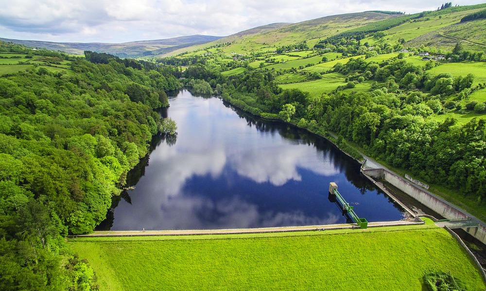
Several years ago the level of the Blessington lake (or reservoir) was artificially made low so that work could be done on the dam. This year the lake has become quite as low as it was then but this time it was due to lack of rain.

On returning from two weeks in the UK I noticed how much lower the level had become and decided to run around the Kings River end on Saturday afternoon (a week ago) to suss it out, it being a warm and sunny day. The experience satisfied. The area where the Kings River enters is normally flooded and out of my depth but now the river channel was narrow and shallow, with large sand banks exposed. And I met some regular fishers who asked me where was my dog! I think these were the same folk that, several years back, had helped me find Meg after she had run off after some rabbit or whatever.

I figured I would repeat the exercise one morning this week. Somewhat foolishly as it was only 7 degC and, scantily clad as usual, so I got rather cold. But having got half way around I had to finish which I duly did and am here to tell the tale. No swimming though.

This Sunday afternoon the weather was clement and, having attended to two WC's in the house here that had broken (story of my life) but having nothing else pressing to do, I set out again, this time armed with a camera.  The latter was because I reckoned the lake, so low, warranted Special Attention. I passed the usual fishing regulars and several others.

S'funny. My son went off fishing at much the same time as I left for my run. And these men I passed who asked after my dog: doubtless they look at me, besmirched with mud, and think 'crazy guy'. And I look at them with similar lack of comprehension. But we share the same lake amicably.

As usual you can enlarge my pictures by clicking on them.

My route around Kings River end of lake from Bing maps

To start I cross the bridge and climb over the parapet at 'A' and go around the Kings River end of the lake in an anticlockwise direction (the same course as my son and I did many years ago on mountain bike and petrol scooter, only that time the tide was in). I run where I can, but some areas are too stony and slow me down. The course would be very difficult it tackled shod.


Lots of dykes, ditches and hedges not normally visible

And a zillion new islands and penisulae

And all rather muddy

From 'B' looking back towards the bridge

The level has never become low enough to access this island near 'C'

Ancient roadways appear - this one at 'D'

This stream at 'E' is normally an inlet to the lake

Kings River at 'F'

Kings River looking towards lake - note the people!

All this area is normally flooded

Fording the river knee deep, it is usually an out of my depth swim

A week ago the river was a mere stream. And I've seen it far more bloated than in this picture. One needs to watch the weather before making assumptions about its depth and flow.

Looking up Kings River, all this is normally part of the lake

Looking back along the river   lake from 'G'

This and a piebald horse were near 'H' on all three runs


Near 'J' looking south

Near 'J'

Note the partially submerged fences

A Very Muddy Place near 'K'

Ordance Survey Ireland have an on-line map service where you can overlay a modern map (of the lake) with a historic map (dated 1888-1913, before the lake was flooded), which shows the above fence-lines. The photo above was taken from where the stream (blue) crosses the fence-line (orange).


Back to the bridge at 'L'

The closest post is dry when the lake is "normally low"

Civilisation