Showing posts with label Cleevaun Lough. Show all posts

20220327

Mullaghcleevaun

 First proper foray of 2022. The occasion being the first decent weather this year.

Hiking part 9.1 miles, elevation gain 787m

Bike to Pound Lane, Lacken, then hike over Black Hill to Mullaghcleevan then back via beautiful Cleevan Lough. Then bike back via Blessington. Fuel: one creme egg plus one granola bar.


20190814

Four peaks again

This time S and I took some visitors with us. It was the same route although I made the hike more accessible by ferrying them by car to the start and from the finish, reducing the hike to a total of 10.7 miles. We did well, no bones broken, all present and correct though tired, but there's a big difference between being on one's own (you can choose your own pace, and choose to take no backpack) and being with a group (you are sort of obliged to carry lunch and water and spare clothing for emergencies because.., and your pace is set by the weakest, so that S and I had to repeatedly stop and wait, getting cold in the process). And to add insult, before the hike I had run six miles first thing in the morning, and in addition the car was full so I had to bike to the start and run back from the finish. I was the only one bare foot. The others realised the benefit - their shoes were sodden - but steadfastly resisted.  Not that I would recommend a mountain for one's first encounter with no shoes.

20190622

Four peaks and Mullaghcleevaun again

A gorgeous day - could it be summer? - and the hills were calling me again. This time I biked to Ballyknockan (marked "Start" on the map) and hiked from there.  The route encompassed four peaks: Silsean, Moanbane, Mullaghcleevaun and Black Hill, and included my Favourite Place lough Cleevaun, which I entered by its back door. I swam a few strokes in the lough - it was a bit cold and I am not a strong swimmer so am cautious when on my own.

My track

Track statistics indicate just short of 13.5 miles hiking. My "hiking" includes jogging when the conditions are favourable. Elevation gain 1137m with maximum altitude 845m. The biking part was a bit less than 4 miles each way.

The road bit back to my bike was hard work - my legs no longer wished to run and I needed a drink. But the mountain and lake part of the hike was wonderful, idyllic, almost unbelievable. The weather was warm but not too hot, and the hills were alive! Meanwhile some others from the community were at a CrossFit do all day (it was in aid of cancer research). Fair play to them and I hope they enjoyed their day as much as I did. I cannot imagine that they did, mind you, but then that is my perspective.  I prefer having the hills to myself so let the Others do what they will.

These photos have got themselves in reverse order - it was my first time importing directly from Google Photos, I must try harder next time! You can enlarge the pics by clicking on them, then use cursor keys to navigate through the album.

Back to civilisation but my feet didn't want to run any more

Thank you, kind landowner, and yes, I did have
appropriate footwear (none) and clothing (not much)...

Green road and war memorial

The amazing Green Road 

One of many spot the deer photos

Zoomed in

Black hill in the distance, and my way home

West end of lough Cleevaun

The lough from the west end

Shore at east end, a good place to camp

The peat (turf) fields nearby, barefoot runners paradise

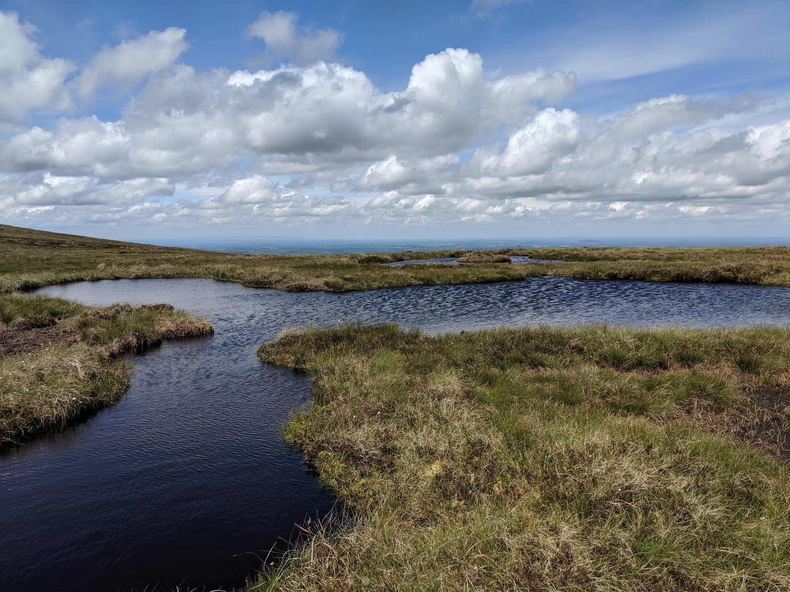
Close up of the small pond 

A small shallow pond near the lough

Another view of the sandy shore

Same again (do I love this place?)

Proof that I was there

Waterfalls on the slope of Mullaghcleevaun

From the shore looking west

First sight of lough Cleevaun from its back entrance

Mullaghcleevaun from Moanbane summit

Silsean from Moanbane summit

The small and bottomless pond and Moanbane summit marker

Silsean and the pond in the saddle

Same again - Riche swam here when we took him camping


20190618

Mullaghcleevaun new route

There are some forestry tracks on the left just before the final ascent to the Wicklow Gap on the R756 heading Eastwards. The challenge was to make it to Mullaghcleevaun from home in an afternoon on bike and barefoot. Because of the off-paved-road segments I thankfully rode my old bike up to the summit of these forestry tracks (red arrow on map), then headed on foot.

The interesting part of my track
Distance on bike 21 miles roundtrip, elevation gain 498m
Distance on foot 6.6 miles roundtrip, elevation gain 407m

It was hardly running - too much boggy peat for that. Surprisingly I met two hiking parties. The chief guy on the second party stopped to talk with me. I was dressed in running shorts, period. He was dressed in typical hiking gear, boots and walking sticks. He asked me if I was all right. He repeated - was I sure I was all right?  I suppose we come for different universes.

On the return journey I mounted my bike and careered down the steep forestry track only to find that its sharp stones had punctured my rear tyre. I had no repair tools so was forced to ride the rest of the way home on the rim. And at that point it started raining... I made it home a little later than planned.

I had a spare inner tube at home, so the bike is now operational again - the rim (being steel) was not badly damaged and I was even able to re-use the outer tyre, though I would not recommend going any great distance on the bike now. Its main use, now I have a decent road bike, is for getting around the farm here. As usual you can click on the photos to enlarge them.


The ridge trail soon after leaving my bike, towards Tonalagee

Same, looking towards where I left the bike

Much of the ridge is peat like this

With wet bits

Mullaghcleevaun summit

Wet on the top too

Lough Cleevaun from high above

A bit to the right and Mullaghcleevaun East Top


20180630

Lough Cleevaun

On this very hot Saturday afternoon the Others having gone to Glendalough for a walk leaving me with no particular duties, I decided to go on my own walk. So I drove to the small car park above Lacken and took the usual route via Black Hill to Mullaghcleevan mountain with Cleevaun Lough as the final destination.

the interesting part of my track

Total distance 9.29 miles, average speed 3.28mph (ok so I ran some of the downhill bits), elevation gain 655m, maximum elevation 847m.

Altitude with time profile

Having got so close it seemed a shame not to climb Mullaghcleevaun so I did, and followed that with its East Top before heading back to Cleevaun Lough which I therefore approached from a new direction. I met only one other soul - she was heavily equipped as hikers are c/w two walking sticks, so what she made of me, scantily clad and barefoot, I know not. After that I had the mountains and lake completely to myself and made the most of it.  The flat part of the altitude profile above is time I was at or near the lake.

As always you can click on the images to show them at full resolution.


Our lake from the car park, note the smoke haze

Black Hill summit, gorse fires at Sally Gap in the distance

There is an ongoing "gorse fire" in the Sally Gap area, with firefighters and even helicopters trying to contain it. This has resulted in smoke haze in our area for the last 48 hours or so. Today the gentle east wind was carrying most of it Blessington way and thus not so much our way.


Smoke haze meeting the gentle east wind before Moanbane

The final climb to Mullaghcleevan summit ahead

Mullaghclevan summit, note the distant gorse fire smoke

Strange terrain on the way to the East Top

There are "fields" of peat between the summit proper and the slightly lower East Top - all dry in this hot weather and wonderful for running barefoot on.


East Top summit, fire in distance again

Lough Dan in the distance looking towards the east

First sight of the gem Cleevaun Lough

One of the many riverlets feeding the lake

Lough Cleevaun is a glacial corrie lake. The photo above shows how it "hangs" on the north slope and it amazes me how it continues to hold water. But it does and for me it is a magical place. Not many come here and thus one can swim naked with reasonable assurance of not being Seen.


Looking down into the water

The lake in all its glory and it was truly glorious

The water remains quite shallow near this "beach" and the bottom is studded with rocks. Being peaty the water appears black once more than about a foot deep and it is therefore somewhat treacherous on bare feet. So I choose my "safe" swimming location along the steeper slope on the left and here I enjoyed a brief swim. I have never known the water so warm. I could have stayed in this place all day, but had to get back for supper at 6.

The beach

North-west end of the lake - my lens must be smeary

Back at Black Hill summit, overlooking our lake

And back at the car park