Showing posts with label ballinabarny gap. Show all posts

20200914

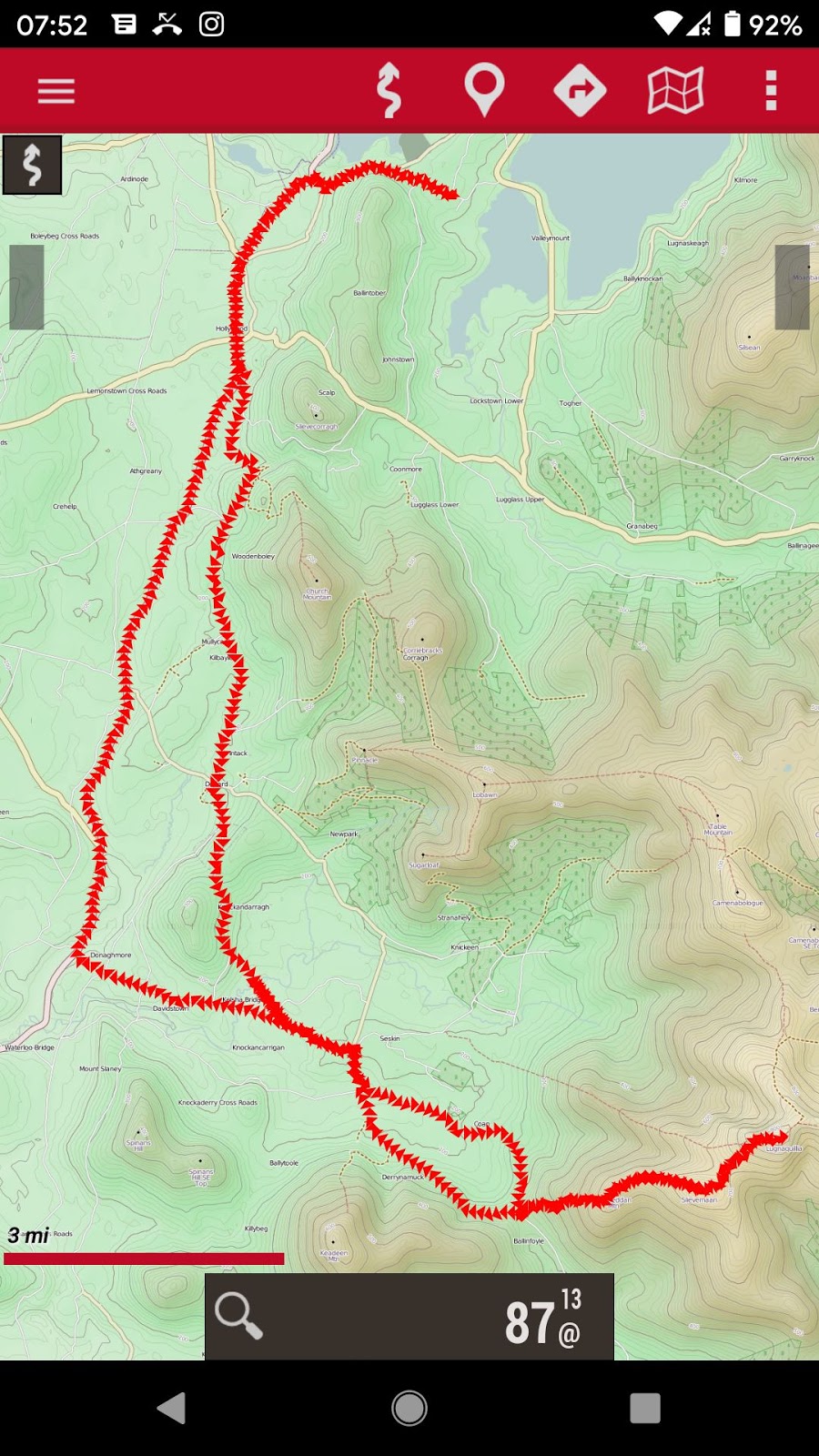
And then Lugnaquilla

Whole track 42 miles

Hiking part: 6.8 miles there and back

I passed the access point (trail head) on my way back from Keadeen and, after checking the map, this sparked enough interest to do it.  My cycle route was similar, and I parked the bike at Ballinabarney Gap and set off. It was Sunday afternoon and I met several other hikers including a couple possibly older that 1, which was kind of encouraging.

Kelsha Bridge over Slaney

A cool place to swim (literally)

On the way there, and again on the way home, I stopped for a swim in the Slaney River.  Why not, I asked myself? After all I'm here to enjoy myself.

My photos follow, or if you prefer a Google Album go here.

The access point / trail head

Looking back climbing Ballineddan 704m

The goal before me 

Slievemaan summit 811m

Looking back to Keadeen

Lugnaquilla, two hikers coming over the crest

From the summit

Others were there

Mostly kitted up

Turlough Hill somewhere in the distance

A thingy to tell what you're looking at

The military warning sign

Returning

Goodbye Lugnaquilla


20200831

I climbed Keadeen

My track: 36.4 miles cycling

and 4.4 miles hiking

A new mountain peak for me: Keadeen at the south west limit of the Wicklow Mountains and standing somewhat separate connected only by the Ballinabarny Gap.  It was Sunday and I met several other groups tackling the peak, though none without shoes and mostly with those hiking sticks which I abhor (at least for easy hiking like this). There was even a parking place, which I biked to from home, and the trail was well used though boggy in places.

Overall stats: 40.8 miles, elevation gain 1394m, maximum 658m though, interestingly, other sites report varying heights e.g. 653m, 635m, and OpenTopoMap, which is the best open sourced map ever, reports a spot height of 705.3m though its contours do not bear this up.

Here is a pile of my photos, the last one being of mist rising from our lake the early morning after. Click on the images to view full-screen.


20151004

Club Orange at Ballinabarny Gap


Bike ride today: Wicklow Gap, Rathdrum, Aughrim, followed the River Ow, lunch stop at Ballinabarny Gap, Knockanarrigan, N81, Piper Stones, home. Total 61.4 miles, max 38.8mph, avg 11.1mph, knees hurting towards end. Consumed one can Club orange (as good as Jusoda was, and so much better than Fanta), one cheese sandwich, half a 200g bar of CDM. And a bit of water.

Ballinabarny Gap, osi

Downhill behind Knockalt caught in morning sun

Bridge over river Ow

View from Ballinabarny Gap

Off the N81 near Hollywood

Piper's stones

Piper's stones